|
|
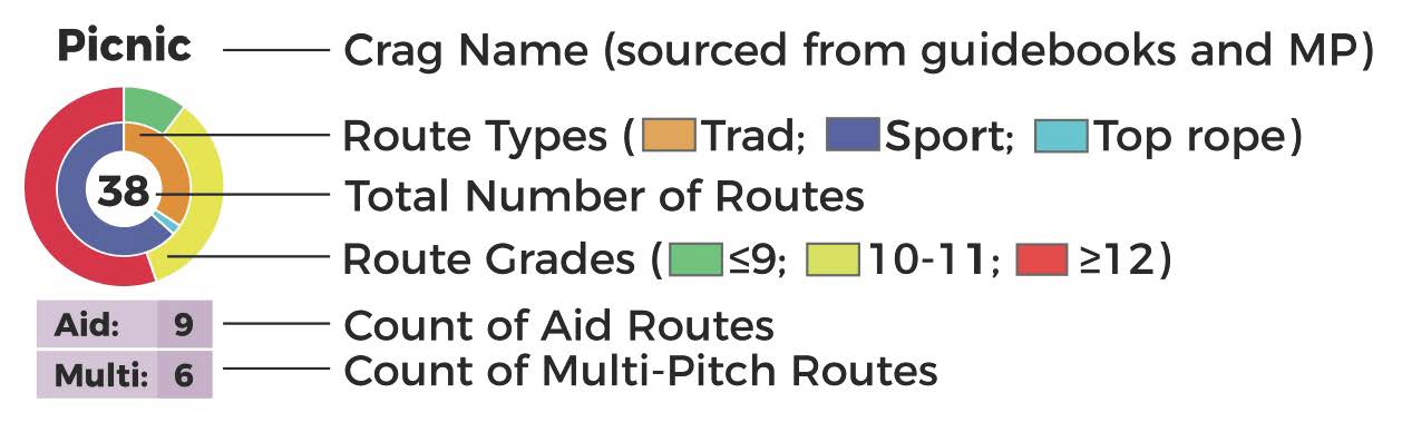
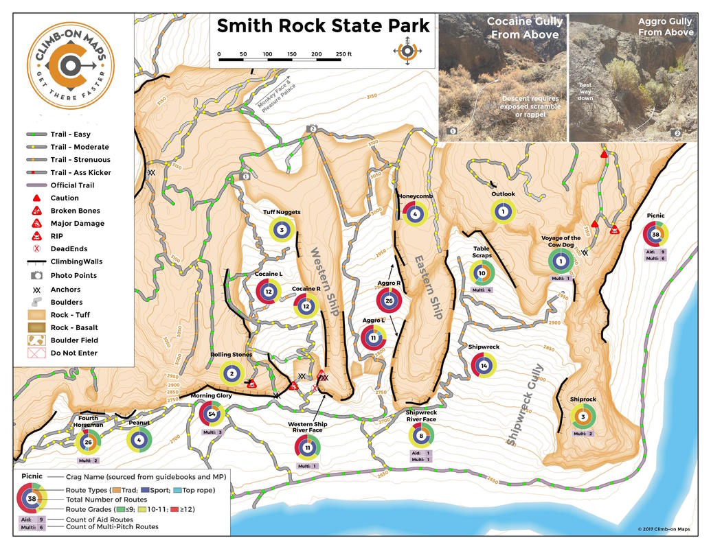
Map excerpt images - does not represent the entire map (the maps covers ALL of Smith Rock and includes adjacent BLM areas.) |


- 24" x 36" Fold out map (4" x 9" folded)
- Waterproof/tear-proof
- 2-sided
- Large overview map of all of Smith Rock State Park and adjacent BLM areas.
- Detailed insets (1:1,500)
- Alphabetized crag finder (using names found in Alan Watt's guidebook and Mountain Project)
- Approaches and walk-offs
- Trail difficulty ratings (easy, moderate, strenuous, ass kicker)
- Points of exposure (broken bones, major damage, Rest In Peace - RIP)
- Crag summaries (distribution of climb types, grades, number of multi-pitch and aid climbs)
- Walking-accessible top rope access noted